Machine Learning with Remote Sensing in Google Earth Engine

  • Overview
  • Curriculum
  • Instructor
  • Review

About This Course

Learn to apply machine learning, remote sensing, big spatial data using the Google Earth Engine cloud computing

Do you want to learn how to access, process, and analyze remote sensing data using open-source cloud-based platforms?

Do you want to master machine learning algorithms to predict Earth Observation big data?

Do you want to start a spatial data scientist career in the geospatial industry?


Enroll in my new course to master Machine Learning with Remote Sensing in Google Earth Engine.


I will provide you with hands-on training with example data, sample scripts, and real-world applications.  

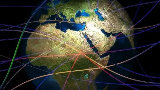
By taking this course, you will take your geospatial data science skills to the next level by gaining proficiency in applying machine learning algorithms to predict satellite data using an open-source big data analytics tool, Earth Engine API, a cloud-based Earth observation data visualization analysis by powered by Google.


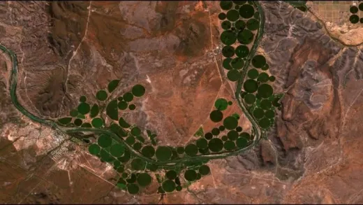
In this Machine Learning with Earth Engine API course, I will help you get up and running on the Google Earth Engine cloud platform. Then you will apply various machine learning algorithms including linear regression, clustering, CART, and random forests. We will use Landsat satellite data to predict land use land cover classification. All sample data and scripts will be provided to you as an added bonus throughout the course.


Jump in right now to enroll. To get started click the enroll button.

  • Learn to learn applying machine learning algorithms using satellite data

  • Learn processing analyzing large volume of remotely sensed satellite data with the Earth Engine API

  • Learn to collect reference training data for image classification

Course Curriculum

2 Lectures

1 Lectures

1 Lectures

1 Lectures

1 Lectures

1 Lectures

1 Lectures

Instructors

Profile photo of Dr. Alemayehu Midekisa
Dr. Alemayehu Midekisa

Dr. Alemayehu Midekisa is a geospatial data scientist with over 15 years of professional experience in academia and industry. His research focus is on leveraging geospatial AI, big Earth observation data, and cloud computing to monitor environmental changes. Dr. Midekisa is particularly interested in applying machine learning models, large-scale remote sensing data, and cloud computing such as Google Earth Engine...

Instructors

Profile photo of Spatial eLearning
Spatial eLearning

Spatial eLearning provides online courses teaching remote sensing, GIS, machine learning, cloud computing, and spatial data science skills. Our mission is to make highly valuable geospatial data science skills accessible and affordable to anyone and anywhere around the world. We teach 20,000 plus students in over 170 countries around the world. Spatial eLearning’s valuable learning resources include webinars, books, free...

Review
4.9 course rating
4K ratings
ui-avatar of Pawan Kumar
Pawan K.
4.0
1 year ago

nice

  • Helpful
  • Not helpful
ui-avatar of Jeff Tennis
Jeff T.
1.5
2 years ago

Code is outdated (i.e. fusion tables, CART classifier, etc).

Poor or no explanation of contents or how imagery files are constructed. not worth it and Udemy should remove the course.

  • Helpful
  • Not helpful
ui-avatar of Loukili Yassine
Loukili Y.
1.0
2 years ago

The machine learning features used in the course are no longer available. he has to redo the course.
here are the errors i got when i tried to test the scripts:

ConfusionMatrix (Error)
Classifier.cart: This classifier has been removed. For more information see: http://goo.gle/deprecated-classifiers.

ConfusionMatrix (Error)
Classifier.randomForest: This classifier has been replaced. For more information see: http://goo.gle/deprecated-classifiers.

Number (Error)
Classifier.randomForest: This classifier has been replaced. For more information see: http://goo.gle/deprecated-classifiers.

  • Helpful
  • Not helpful
ui-avatar of Brinda Kashyap
Brinda K.
3.5
3 years ago

so far it's good. I am very new to the concept of google earth engine ,hoping to get more clarity by the end of the course

  • Helpful
  • Not helpful
ui-avatar of Desmond Lartey
Desmond L.
3.5
3 years ago

it was generally good, just a lot of repetition and explanatory lines of codes. It should also be reviewed if APIs are deprecated.

  • Helpful
  • Not helpful
ui-avatar of Susana del Carmen
Susana D. C.
5.0
3 years ago

si muy buena

  • Helpful
  • Not helpful
ui-avatar of Muhammad Ichsan
Muhammad I.
4.5
5 years ago

Please give english subtitles,
more concept of Machine Learning & Remote Sensing Theories

  • Helpful
  • Not helpful
ui-avatar of Dr. Bhavik Patel
Dr. B. P.
4.0
5 years ago

Yes so far this is meeting to my expectation. But there are couple of things that worries me like the interface of Google Earth Engine that course provider is using is not matching with the interface that i am using. And i have submitted my request to Google Earth Engine for an account 8 days ago and still awaiting the confirmation.

  • Helpful
  • Not helpful
ui-avatar of Harshita Tiwari
Harshita T.
3.0
5 years ago

The course has just started. I cant say anything at this moment.

  • Helpful
  • Not helpful
ui-avatar of Shiva Pariyar
Shiva P.
3.0
5 years ago

I could not understand timestamp. So could you please elaborate about it in Detail? Also I need ensemble of all these algorithms.

  • Helpful
  • Not helpful
Leave A Reply

Your email address will not be published. Required fields are marked *

Ratings

Courses You May Like

Lorem ipsum dolor sit amet elit
Show More Courses