Brief Summary
This course teaches you the fundamentals of remote sensing and GIS using Google Earth Engine. You'll get hands-on experience with satellite data, learn key image processing skills, and apply these skills to real-world problems in the geospatial industry.
Key Points
-
Basics of image processing and geospatial data analysis
-
Hands-on experience with Google Earth Engine
-
Real-world applications using satellite data
-
Techniques like mosaicking, compositing, and classification
-
Free open-source tools for accessing and analyzing data
Learning Outcomes
-
Master basic concepts of remote sensing
-
Gain hands-on skills in image processing techniques
-
Learn to analyze and visualize GIS and Earth Observation data
-
Become proficient in using Google Earth Engine for geospatial tasks
-
Acquire skills that prepare you for jobs in the geospatial field
About This Course
Learn the basics of image processing, geospatial data analysis, GIS and cloud computing with Google Earth Engine
Do you want to learn the fundamentals of remote sensing?
Do you want to learn how to access, process, and analyze remote sensing and GIS data using free open-source tools?
Do you want to solve a real-world problem using freely available satellite data?
Do you want to acquire new hands-on Remote Sensing skills that will prepare you for a remote sensing and GIS job in the geospatial industry?
Enroll in this Fundamentals of Remote Sensing with Google Earth Engine course.
I will provide you with hands-on training with examples of GIS and Remote Sensing data, sample scripts, and real-world applications.
By taking this course, you will take your satellite remote sensing skills to the next level by gaining proficiency in satellite remote sensing and geospatial analysis with GEE, a cloud-based Earth observation, and GIS data visualization analysis powered by Google.
In this Fundamentals of Remote Sensing and Image Analysis course, I will help you get up and running on the Google Earth Engine JavaScript API platform form to process and analyze geospatial data. By the end of this course, you will be equipped with a set of new Remote Sensing skills including accessing, downloading processing, analyzing, and visualizing GIS and Earth Observation big data.
The course covers various topics including introduction to remote sensing, types of resolutions, remote sensing data sources, digital image processing, and image classification.
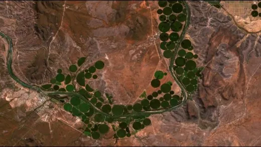
In this course, I will use real satellite data including Landsat, MODIS, Sentinel-2, and others to provide you with a hands-on practical experience of working with freely available remotely sensed data. I will walk you through using a step by step video tutorials to process and analyze remote sensing data using a cloud platform. In addition to learning the basic concepts, theories, and terminologies, you will also learn the steps for image processing including mosaicking, resampling, reprojections, compositing, spectral unmixing, spectral transformation, and classification using real-world satellite data and example scripts. All sample data and scripts will be provided to you as an added bonus throughout the course.
Jump in right now to enroll. To get started click the enroll button.
At the end of this course, students will be able to master concepts in remote sensing
Learn the basics of remote sensing principles
Master the image processing skills: mosaicking, compositing, resampling, reprojection, spectral unmixing, and classification


Bruno G. M.
It's a good course for those who are new to GEE (like me), but I think it could go up to the intermediate level at least. However, the course gives a good initial overview and awakens curiosity about the tool, so I recommend it for beginners.