Big Geospatial Data Analysis with Google Earth Engine

  • Overview
  • Curriculum
  • Instructor
  • Review

About This Course

Learn to analyze, visualize big Earth observation data, Remote Sensing, GIS, Google Earth Engine Cloud Computing

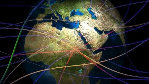
Do you want to access satellite sensors?

Do you want to visualize big Earth observation Remote Sensing GIS data?

Do you want to extract information from satellite sensors?


Enroll in my new course Big Geospatial Data Analysis with Google Earth Engine.

I will provide you with hands-on training with examples of GIS and Remote Sensing data, sample scripts, and real-world applications. By taking this course, you will take your geospatial data science skills to the next level by gaining proficiency in accessing satellite sensors, visualizing big Earth observation data, and extracting information from satellite data.


In this Big Geospatial Data Analysis with Google Earth Engine course, I will help you get up and running on the Earth Engine cloud platform access satellites, visualize big data, and extract information from satellites.


By the end of this course, you will be equipped with a set of new skills including accessing, downloading, visualizing big data, and extracting information.


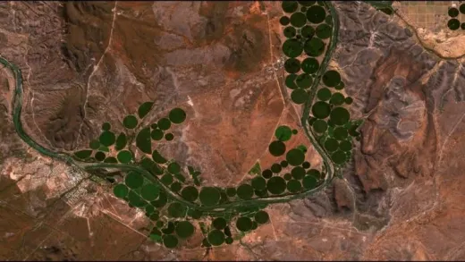
In this course, I will use real satellite data including Landsat, MODIS, Sentinel-2, and others to provide you a hands-on practical experience of working with Earth observation data.

One of the common problems with learning image processing is the high cost of software. In this course, I entirely use the Google Earth Engine JavaScript open-source cloud platform. Additionally, I will walk you through using a step by step video tutorials to process and analyze GIS and Remote Sensing data with GEE. All sample data and scripts will be provided to you as an added bonus throughout the course.

Jump in right now to enroll. To get started click the enroll button.

  • Download varies satellite data for free

  • Students will access and sign up the Google Earth Engine platform

  • Apply Remote Sensing and GIS techniques to process and analyze various vector data

Instructor

Profile photo of Dr. Alemayehu Midekisa
Dr. Alemayehu Midekisa

Dr. Alemayehu Midekisa is a geospatial data scientist with over 15 years of professional experience in academia and industry. His research focus is on leveraging geospatial AI, big Earth observation data, and cloud computing to monitor environmental changes. Dr. Midekisa is particularly interested in applying machine learning models, large-scale remote sensing data, and cloud computing such as Google Earth Engine...

Review
4.9 course rating
4K ratings
ui-avatar of SHANKAR VERMA
Shankar V.
4.0
2 years ago

Yes this course is helpful

  • Helpful
  • Not helpful
ui-avatar of Anonymized User
Anonymized U.
4.5
2 years ago

The course was so informative and very constructve

  • Helpful
  • Not helpful
ui-avatar of Edward Durell
Edward D.
2.0
2 years ago

Too heavy on Javascript for my learning purposes.

  • Helpful
  • Not helpful
ui-avatar of Dwi Rizky Rachmadhani
Dwi R. R.
5.0
3 years ago

good

  • Helpful
  • Not helpful
ui-avatar of Shenghan Di
Shenghan D.
5.0
4 years ago

Very good intro course. Completely example based which is the best way to learn GEE. Examples are somewhat repetitive but they cover foundational info which I suppose is unavoidable. Recommended.

  • Helpful
  • Not helpful
ui-avatar of Wilian da Silva Ricce
Wilian D. S. R.
5.0
4 years ago

It is very helpful...

  • Helpful
  • Not helpful
ui-avatar of Valentina Bresciani Blicharz
Valentina B. B.
5.0
4 years ago

perfect course!!!!!great short theoretical background and well explained basic scripts. thanks

  • Helpful
  • Not helpful
ui-avatar of Chrispine O. Omondi
Chrispine O. O.
5.0
4 years ago

Great course with good and clear illustrations. Very comprehensive in imagery access and visualization.

  • Helpful
  • Not helpful
ui-avatar of Wellington Tavares dos santos
Wellington T. D. S.
3.0
4 years ago

O curso trata de tópicos importantes, contudo há pequenos detalhes nos códigos não bem esclarecidos, o que dificulta a entendimento do mesmo. Outro ponto negativo é a não disponibilização dos scripts de cada aula.

  • Helpful
  • Not helpful
ui-avatar of Phuong M Nguyen
Phuong M. N.
4.0
5 years ago

I appreciate the clear and detailed instructions and explanations of codes for different types of data, which makes them incredibly helpful for one-time help with one task. When viewed in sequence, however, 4-5 vides in each series (Sections 3, 4 and 5) are very similar and somewhat repetitive. Overall, thank you for the great work!!

  • Helpful
  • Not helpful
Leave A Reply

Your email address will not be published. Required fields are marked *

Ratings

Courses You May Like

Lorem ipsum dolor sit amet elit
Show More Courses