Introduction to Google Earth Engine

  • Overview
  • Curriculum
  • Instructor
  • Review

About This Course

Learn google earth engine and GIS data with open source cloud computing platform

Do you want to learn how to access and analyze geospatial data on the cloud?

Are you interested in writing JavaScript programming to process satellite data?

Do you want to get the next cool GIS technology job that requires new cloud-based analytic skills?


Enroll in my new course to master geospatial analysis with Google Earth Engine cloud computing.


I will provide you with hands-on training with example data, sample scripts, and real-world applications.  

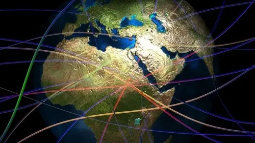
By taking this course, you will take your geospatial data science skills to the next level by gaining proficiency in satellite remote sensing and geospatial analysis with Google Earth Engine JavaScript API, a cloud-based Earth observation data visualization analysis powered by Google.

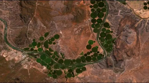
In this Introduction to Google Earth Engine course, I will help you get up and running on the Google Earth Engine cloud platform to process and analyze geospatial data In the course, we will introduce you to the Google Earth Engine cloud computing platform. Then we will cover a range of topics on Earth Engine including image visualization, image metadata, mathematical operations, filtering image collections, geometric operations, filtering feature collection, plotting histograms, and time series charts.

I have designed the course to teach you JavaScript from scratch and no prior programming experience is necessary. I will also provide you with practical exercises so that you will get hands-on experience.


One of the common problems with learning image processing is the high cost of software. In this course, I entirely use the Google Earth Engine JavaScript API open-source cloud platform. Additionally, I will walk you through a step by step video tutorials to process and analyze Earth observation and geospatial data with GEE. All sample data and scripts will be provided to you as an added bonus throughout the course.

Jump in right now to enroll. To get started click the enroll button.

  • Sign up Google Earth Engine

  • Write JavaScript to analyze spatial data

  • Access global scale geospatial data on Google cloud platform

Course Curriculum

2 Lectures

3 Lectures

2 Lectures

1 Lectures

Instructor

Profile photo of Dr. Alemayehu Midekisa
Dr. Alemayehu Midekisa

Dr. Alemayehu Midekisa is a geospatial data scientist with over 15 years of professional experience in academia and industry. His research focus is on leveraging geospatial AI, big Earth observation data, and cloud computing to monitor environmental changes. Dr. Midekisa is particularly interested in applying machine learning models, large-scale remote sensing data, and cloud computing such as Google Earth Engine...

Review
4.9 course rating
4K ratings
ui-avatar of Itallo Dirceu Costa Silva
Itallo D. C. S.
4.0
2 years ago

Muito bom

  • Helpful
  • Not helpful
ui-avatar of Ojih Samuel
Ojih S.
5.0
4 years ago

initially i only knew few functions of the GEE but this course was helpful in making me realize that there are great potentials to be derived from GEE.
Thanks

  • Helpful
  • Not helpful
ui-avatar of Nikolaus Gribb
Nikolaus G.
3.5
5 years ago

Could use a bit more on the analysis overview. This course would be a great Section of a more in depth course that includes chart and graphing utilities.

  • Helpful
  • Not helpful
ui-avatar of Thomas Werner
Thomas W.
2.5
5 years ago

It is hard to follow javascript code in tool. Tried to load feature collection, but earthengine threw error. Something is wrong with string
var countries = ee.FeatureCollection('ft:1tdSwUL7MVpOauSgRzqVTOwdfy17KDbw-1d9omPw');

Some lecture included resources, which was very helpful. All lectures should have included features so I could follow lecture and type my own js.

  • Helpful
  • Not helpful
ui-avatar of Kopo Oromeng
Kopo O.
3.5
5 years ago

First time taking a course on UDEMY, this course was good but as a first introduction to GEE I was expecting a deeper breakdown of the functions and more explanation of what I can do with it. Case study examples would have worked better too......e.g. what might you choose to use buffer and centroids in the Nile Delta for.

The last section was also the most useful for me.

  • Helpful
  • Not helpful
ui-avatar of Charles Gemaque
Charles G.
3.0
5 years ago

por enquanto está sendo positivo

  • Helpful
  • Not helpful
ui-avatar of Angela Ugo
Angela U.
4.0
5 years ago

Yes it was

  • Helpful
  • Not helpful
ui-avatar of Amiraslan Fila
Amiraslan F.
2.0
5 years ago

The lectures are very superficial with lots of obvious pronunciation mistakes (eg. composite) which shows that the lecturer has done very little effort to augment the quality of the course he provides.

  • Helpful
  • Not helpful
ui-avatar of Narayan Thapa
Narayan T.
5.0
5 years ago

This is the best course for the beginner.

  • Helpful
  • Not helpful
ui-avatar of Yasser Almadhoun
Yasser A.
3.0
5 years ago

very good introductory tutorial video

  • Helpful
  • Not helpful
Leave A Reply

Your email address will not be published. Required fields are marked *

Ratings

Courses You May Like

Lorem ipsum dolor sit amet elit
Show More Courses